Money and payments
Cards and cash
Contactless mobile/card payments with Google Pay, Apple Pay, Visa, MasterCard, American Express, and Discover are widely accepted and commonly used.
Tipping
Outside of the food industry, tipping is not common.


 Asia · Western AsiaUsable guide
Country in West Asia
Photo: Neukoln, CC BY-SA 3.0 via Wikimedia Commons
Israel (Hebrew: מדינת ישראל Medinat Yisra'el; Arabic: دولة إسرائيل dawlat ʔisrāʔīl) is a small yet diverse Middle Eastern country. The modern State of Israel was established in 1948 as a homeland for the Jewish people, but the region contains thousands of years of history for many peoples and religions in addition to the Jews. Israel is considered part of the Holy Land (together with areas of Jordan, Egypt and the Palestinian territories), and of the Levant and in ancient history of the Fertile Crescent. The three major Abrahamic religions of Judaism, Christianity and Islam, as well as the Baha'i Faith, have strong ties to this land, and their holy and historic sites are major destinations for pilgrims and tourists from around the world. The Israeli population is about 74% Jews, 21% Arabs, and 5% non-Arab Christians and others. Most of the Jews are descended from Olim (returnees from the Jewish Diaspora), and their diverse origins (Russian, German, Moroccan, Yemeni, and Ethiopian, to name a few of the prominent ones) can be seen in various aspects of modern Israeli culture.
Answers to what travellers most often look up about Israel.
Cards and cash
Contactless mobile/card payments with Google Pay, Apple Pay, Visa, MasterCard, American Express, and Discover are widely accepted and commonly used.
Tipping
Outside of the food industry, tipping is not common.
Arabic, Hebrew
The official language of Israel is Hebrew, a language that was revived in the early 20th century, after having had a status similar to that of Latin among Catholics for over 2,000 years.
Israel is mostly covered with 4G and 5G, but make sure to have VoLTE enabled.
Mobile networks
Tap water is potable and perfectly safe for drinking all throughout Israel (but not in the West Bank or Gaza), big cities and rural parts alike.
There are no special medical issues in Israel, and no immunizations are required for entry. A hepatitis A vaccine is recommended, though.
Covered in the guide
The country as a whole has a Western-oriented outlook on life. Strangers will be more than happy to assist you, help you with anything you need, inquire about you and your background, and give you advice on anything.
Covered in the guide
Attractions, food, stays and travel essentials, with ratings, reviews, opening hours and directions.

the capital and largest city of Israel; a diverse city sacred for millennia to the three Abrahamic religions (Jews, Christians and Muslims). It has an abundance of historic sites from five millennia.
the center of Israel's economy and modern culture, this vibrant city is known as the "White City" for its Bauhaus architecture. It is home to beautiful historic architecture in its Old Jaffa district, and towering skyscrapers, sandy beaches, bustling markets, a vibrant LGBT scene and the largest nightclub scene of the Middle East.
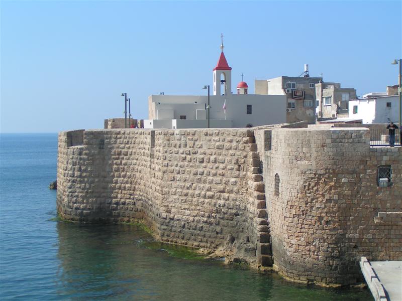
an ancient town with a historic port and the most sacred Baha'i site. Its coastal old town is particularly beautiful

the de facto capital of the Negev region

the 'Goa of the Middle East', Israel's window on the Red Sea, a vibrant resort city

the largest city in northern Israel, this city possesses beautiful seaside views from its peak on Mount Carmel, as well as a rich heritage as a major port city. The city is home to historic Ottoman and Mediterranean-style architecture, with red rooftops, cobbled streets and palm trees. It is home to the ornate Baha'i World Center (a ), and its picturesque gardens, which are considered the city’s major attraction.
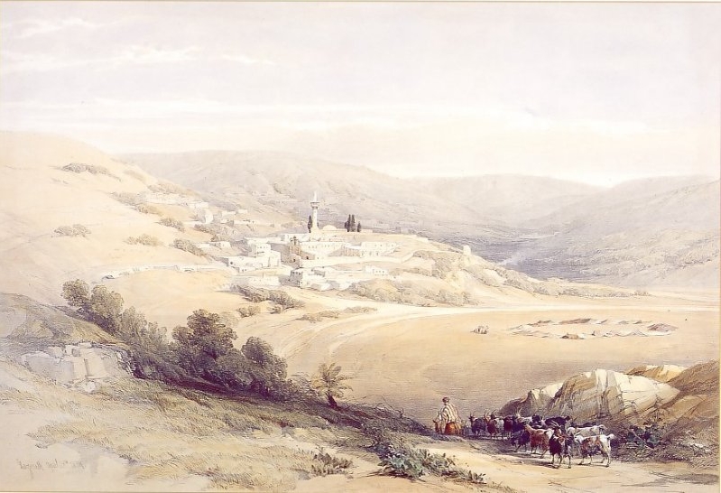
the hometown of Jesus, now the largest Arab city in Israel

Safed (Hebrew: צפת Tsfat) is a city in the Upper Galilee region of Israel, and is one of the oldest centers for Jewish learning and spirituality, home to the Kabbalah movement which is popular with celebrities.
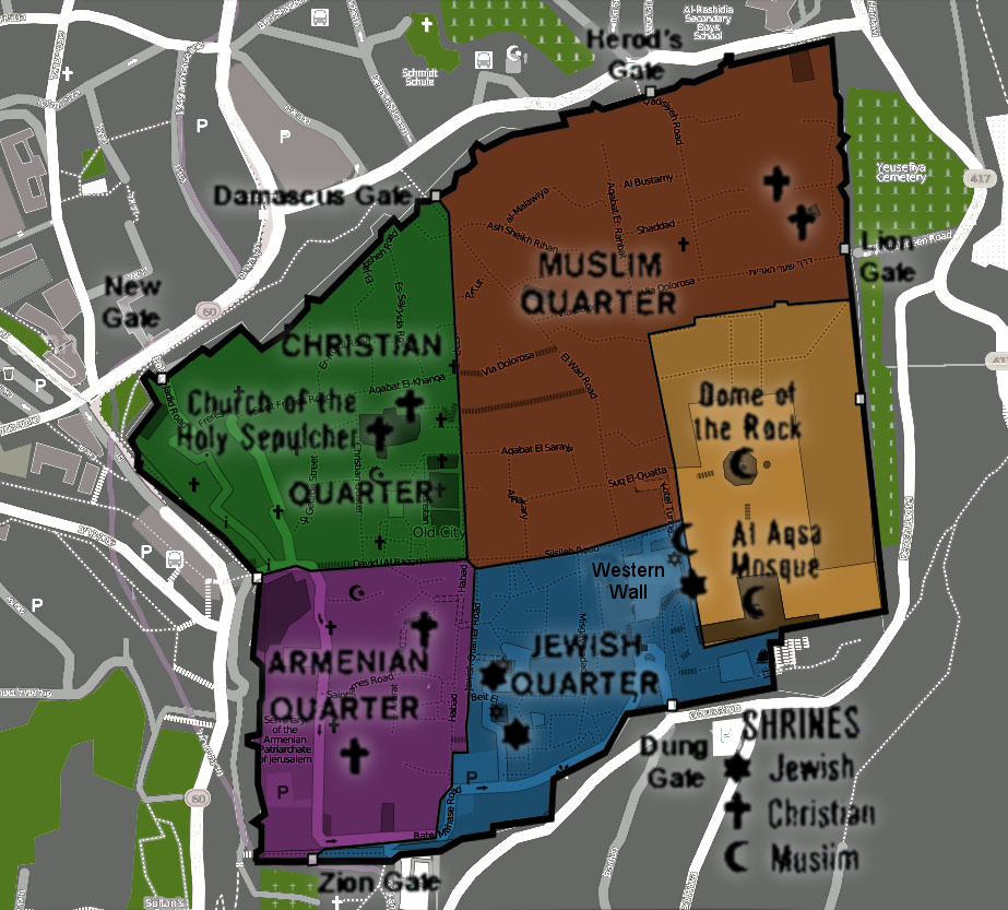
a historic walled area within the modern city of Jerusalem split into four quarters: the Jewish, Christian, Muslim, and Armenian. Tourists of different religions and nations come from around the world to visit its holy sites, which include the Dome of the Rock, the Western Wall and the Church of the Holy Sepulchre. A UNESCO World Heritage site.
One of the oldest port cities in the world, a UNESCO World Heritage site

the home of Jesus of Nazareth and the largest freshwater lake in the country

a sea of hypersalinated water that keeps people afloat and the lowest point on Earth

an extensive inland valley, largely rural, extending inland from east of Haifa to the Jordan Valley
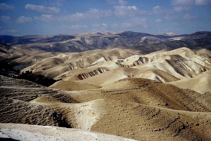
an arid landscape with an array of hills, canyons, and hidden historic sites
center of the Bahá'í Faith, home to the Shrine of the Báb and Terraces, in the northern city of Haifa

high on a plateau above the Dead Sea, the scene of the Zealots' last stand against the might of Rome. A UNESCO World Heritage site.

beautiful steep canyon and a popular hiking spot

an ancient Roman and Crusader city with well-preserved remains
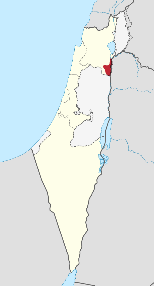
the core of the north Jordan River valley
a Crusader fortress on a ridge in the eastern edge of the Galilee.

remains of a medieval fortress in the northern Golan Heights, 800 meters above sea level.

spectacular caverns on Israel's Mediterranean coast in the Western Galilee in the north of Israel, near the northern border with Lebanon.

40 km long crater-like landform in the middle of the Negev desert, the largest of three similar craters found in Israel. Offers breathtaking desert vistas.

a forested hilly region along the Mediterranean coast, southeast of Haifa
Places in Israel on the World Heritage List.

Incense Route – Desert Cities in the Negev
Listed 2005
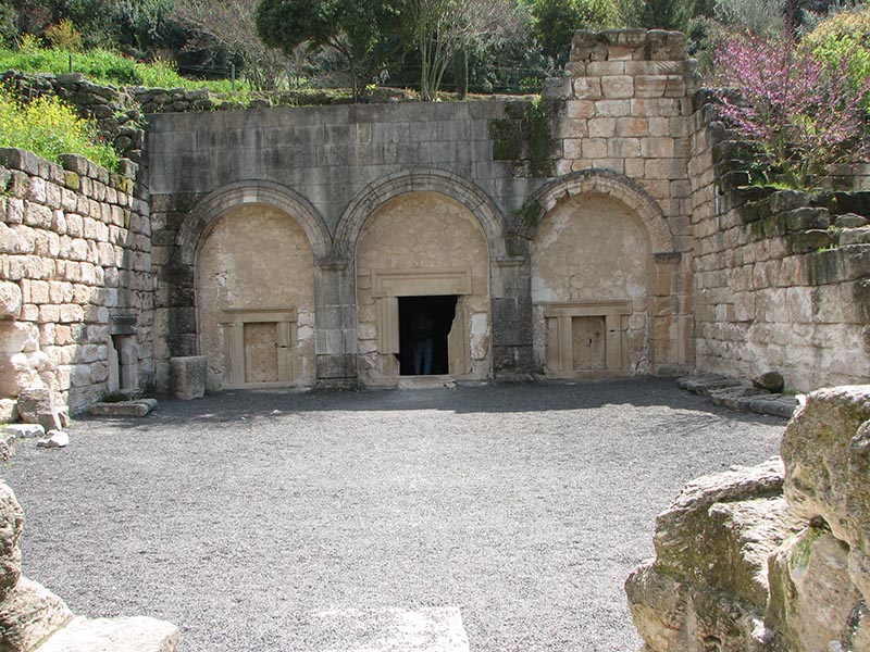
Beit She'arim National Park
Listed 2015
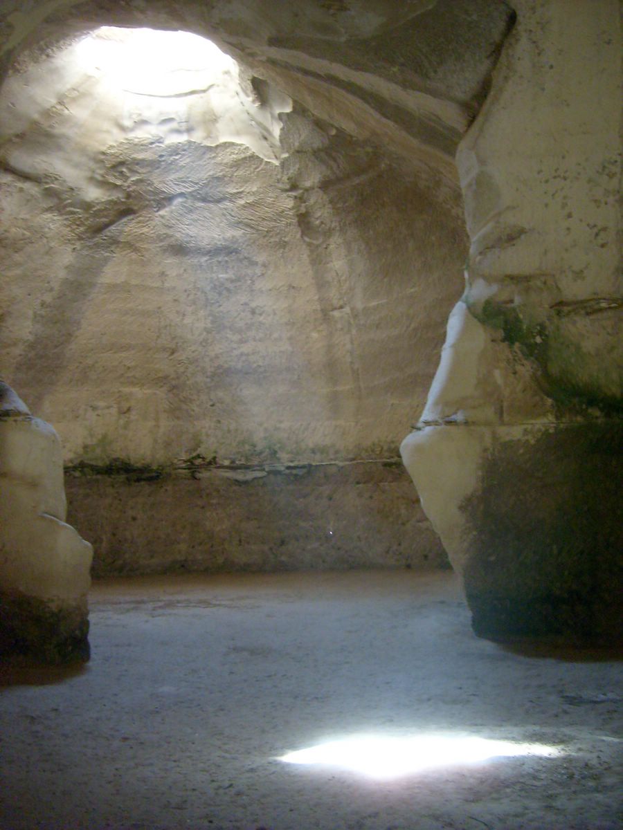
Beit Guvrin National Park
Listed 2014

Bahá'í World Centre buildings
Listed 2008

Church of Our Lady of the Spasm, Jerusalem
Biblical Tels - Megiddo, Hazor, Beer Sheba
Listed 2005

Old City of Jerusalem and its Walls
Listed 1981
List from Wikidata (CC0). Photos from Wikimedia Commons.
A hilly forested region, known for its beautiful landscapes and religious history. The Galilee is composed of five sub regions - the Western Galilee (the northern coastal plain), the Upper Galilee (characterized by mountains, the highest of which is Mount Meron), the Lower Galilee (characterized by relatively low hills separated by valleys), the Galilee Panhandle (in the far northeast), and the Sea of Galilee (the largest freshwater lake in Israel).
Western Galilee, Upper Galilee, Lower Galilee, Galilee Panhandle, Sea of Galilee region
From west to the east; the Carmel Range extends from the Mediterranean Sea to the south-east, containing various towns and villages, as well as Haifa, the third largest city in Israel; the Jezreel Valley is a large valley bounded by the Lower Galilee in the north and the mountains of Samaria in the south; and the Beit She'an Valley lies between the Gilboa mountain range and the Jordan River.
A planar region which stretches along the Mediterranean coast which is the most developed part of the country and in which about 70% of Israel's population lives. This region is characterized by sandy shores and Mediterranean climate. This region contains many cities, towns and villages, including the Tel Aviv urban area, which is the largest urban area in Israel.
A mountainous region in the center of the country, which is a sub-region of the Judaean Mountains. This region includes Israel's capital, Jerusalem, which is the largest city in the country.
The fertile, hilly hinterland bounded by the Coastal Plain in the west, the Judaean Mountains in the east, Samaria in the north, and the Negev in the south.
The Dead Sea, which receives its water from the Jordan River, is the lowest point on earth (427 meters below sea level as of early 2013). The northern half of the western Dead Sea Valley lies in the West Bank and thus Palestine. However, it is part of Area C and therefore under full Israeli control.
The Negev region is a desert area covering much of the south of Israel; sites include the Ramon Crater. The southern parts of the Judaean Mountains region and the Judaean Desert region (the northern parts are on the West Bank) are between the West Bank and the Negev regions. The Arava Valley is the section of the Great Rift Valley that is between the Dead Sea in the North and the Gulf of Eilat in the South and forms part of the border between Israel to the west and Jordan to the east.
Public transport and paid services in Israel.
By bus
Buses are the most common form of public transportation for Israelis and travelers alike. Bus travel is the cheapest way to get around Israel, and is safe and reliable.
By train
Trains are generally quicker and more comfortable than buses. Except in the Galilee, the Dead Sea and the Negev Desert.
By taxi
To differentiate from a shared taxi (sherut), a regular Israel taxi is sometimes called special (using the English word).
By car
Israel has a modern highway network that connects all destinations throughout the country. In general, intercity roads are generally of a quality similar to those in Western Europe.
By plane
Tel Aviv Ben Gurion International Airport to Eilat Ramon airport (or return) is the only active domestic air route. The flight time is between 30 and 45 minutes.
Apps for booking a taxi or a ride in Israel.
Finding apps for Israel…
Other ways to travel:By SherutBy thumbBy bicycleOn foot and navigation
Operators checked against their official websites in October 2026; services that have stopped running are not listed. Logos and Wikipedia links: Wikidata (CC0)
Choose an airport to see hotels, stations, taxi ranks and car rental desks around it.
Tel Aviv · International · TLV
Loading places around the airport…
Calculated from climate averages: mild daytime highs and lower rainfall. It does not account for festivals, crowds or prices.
Average conditions in Jerusalem
| Jan | Feb | Mar | Apr | May | Jun | Jul | Aug | Sep | Oct | Nov | Dec | |
|---|---|---|---|---|---|---|---|---|---|---|---|---|
| Avg. high | 16° | 18° | 21° | 26° | 30° | 33° | 35° | 35° | 33° | 29° | 23° | 18° |
| Avg. low | 5° | 6° | 8° | 10° | 14° | 17° | 19° | 20° | 18° | 16° | 11° | 7° |
| Rainfall (mm) | 59 | 42 | 27 | 15 | 4 | 0 | 1 | 0 | 2 | 11 | 31 | 48 |
| Humidity | 72% | 70% | 66% | 60% | 54% | 56% | 59% | 62% | 63% | 63% | 63% | 68% |
Choose your passport and destination to see whether you need a visa.
Budget
$95
Per person, per day
Mid-range
$265
Per person, per day
Luxury
$700
Per person, per day
| Budget | Mid-range | Luxury | |
|---|---|---|---|
| Accommodation | $45 | $145 | $400 |
| Food and drink | $25 | $65 | $150 |
| Local transport | $15 | $25 | $65 |
| Activities | $10 | $30 | $85 |
Estimate from World Bank price levels (2025). Actual costs vary by city and season. World Bank
—
We do not label countries as safe or unsafe. Below is the official advice from two governments, with the date it was last updated. Always read the full advice before you travel.
US Department of State
Level 3 of 4Reconsider travel
Reissued Statement There were no changes to the Travel Advisory Level. The health risk indicator was added for Gaza. Advisory summary was updated to reflect that family members may travel to Israel. Reconsider Travel to Israel due to terrorism and unrest. Some areas have increased risk. Read the entire Travel Advisory. Do Not Travel to areas north of Route 85 to Route 90 (south) to Route 87 due to armed conflict. Do Not Travel within 11.3 kilometers/7 miles of the Gaza Strip due to armed conflict. Do Not Travel within 2.4 kilometers/1.5 miles of the Israel-Egypt border, except at the area of the Taba border crossing, also known as the Menachem Begin crossing, due to armed conflict. Advisory summary As of August 26, 2026, family members may join U.S. government employees who work in Israel. U.S. government employee travel restrictions U.S. government employees working in Israel are restricted from the following locations due to safety risks: Areas north of Route 85 to Route 90 (south) to Route 87; Within 11.3 kilometers/7 miles of the Gaza Strip; and Within 2.4 kilometers/1.5 miles of the Israel-Egypt border, except at the area of the Taba border crossing, also known as the Menachem Begin crossing. Any official travel of U.S. government personnel within these areas requires approval from the U.S. embassy s security office. Additional movement restrictions may be imposed on U.S. government employees working in Israel, with little to no notice, due to increased security issues or threats. Terrorism There is risk of terrorist violence, including terrorist attacks and other…
UK Foreign, Commonwealth & Development Office
Advises against all travel to parts of the country
Your travel insurance could be invalidated if you travel against advice from the Foreign, Commonwealth & Development Office (FCDO). Areas where FCDO advises against travel Gaza FCDO advises against all travel to Gaza Areas near Gaza FCDO advises against all travel within 500m of the border with Gaza The West Bank FCDO advises against all travel to: Tulkarm Governorate, Jenin Governorate, and Tubas Governorate except Route 90 Northern Israel and Occupied Golan Heights FCDO advises against all travel to: Areas north of Route 89 between Nahariyya and Dalton; north of a straight eastward line from Dalton to Route 91; and north of Route 91 across the Golan Heights, excluding routes 89 and 91 themselves Within 500m of the Area of Separation in the occupied Golan Heights (the ‘Alpha line’). Do not attempt to enter the occupied Golan Heights through Syria Sheba’a Farms and Ghajja Areas where FCDO advises against all but essential travel West Bank FCDO advises against all but essential travel to: The rest of the West Bank, except for: East Jerusalem, Bethlehem Governate, Ramallah Municipality, Jericho municipality and all areas which lie south of it (this includes the Allenby crossing). Highway 1 that links Jerusalem and Tel Aviv and the areas that lie to the south and west of the Highway (this includes Highway 3), and Route 443 and Highway 45 which link Jerusalem and Tel Aviv Find out more about why FCDO advises against travel. Regional tensions The US and Iran announced a memorandum of understanding (MOU) on 17 June in relation to the conflict in the Middle East, however…
Stories, itineraries and practical advice for travelling in Israel.
 Travel tips
Buses are the most common form of public transportation in Israel for Israelis and foreigners alike. They are generally frequent and modern, but often slow.
Wikivoyage
 Nature & adventure
Israel's national parks and nature reserves, of which there are about 75, are managed by the Israel Nature and Parks Authority.
Wikivoyage
 Travel tips
This page is about problems that may arise from evidence of travel to or visa for certain territories. For the issue of visas in general, see Visa.
Wikivoyage
 Nature & adventure
Israel is a very convenient country for hiking in the wild, thanks to its mild and relatively dry weather, relatively unthreatening wilderness, the proximity of natural sites to cities, and not least – its extensive…
Wikivoyage
 Itineraries
The Israel National Trail (Hebrew שביל ישראל, Shvil Yisrael) is Israel’s best-known long-distance hiking trail. It runs for about 1,000 km from the northern edge of the country near Kibbutz Dan to Eilat on the Red Sea,…
Wikivoyage
 Culture & history
Judaism is one of the monotheistic religions, sharing a common origin with the world's two most prolific religions, Christianity and Islam.
Wikivoyage
Every section of the guide. Open one to read it in full.


