//

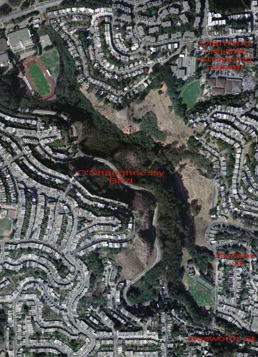
Photo: via Wikimedia Commons, Public domain
A quiet city park great for hiking, dogwalking and nature viewing, containing a steep canyon situated amidst some residential neighborhoods. The park offers a rare glimpse into what the hilly landscape of San Francisco looked like before development. A small creek, Islais Creek, runs through the canyon and is one of the last free-flowing streams in the city.
Glen Canyon Park is a city park in San Francisco, California. It occupies about 70 acres (28 ha) along a deep canyon adjacent to the Glen Park, Diamond Heights, and Miraloma Park neighborhoods. O'Shaughnessy Hollow is a rugged, undeveloped 3.6 acres (1.5 ha) tract of parkland that lies immediately to the west and may be considered an extension of Glen Canyon Park.
© OpenStreetMap contributors
This library was the site of one of the highest profile arrests in the 21st century, as Ross Ulbricht, alias The Dread Pirate Roberts, was arrested here in the Science Fiction section in 2013.
In the middle of a residential neighborhood, Mt. Davidson Park (which boasts the highest point in San Francisco) offers great hiking trails. Mt. Davidson's most distinguishing feature is a 6-story cross nestled among the many eucalyptus trees, which can be seen from various spots in the city depending on which angle you´re looking from. It was constructed as part of the WPA program of the 1930s, and is now dedicated as a memorial to the Armenian Genocide. At the peak, you're rewarded with great views of downtown and the bay.
The small parking area at the northern tip of Twin Peaks Boulevard (875' above sea level) is near the physical center of the city, and one of its highest points, providing spectacular views in all directions. Tour buses can get backed up here during the day, but it's a great place to really appreciate the city from above, especially at and after sunset. Temperatures up there can be quite a bit lower than in the rest of the city, so bring a jacket. Muni bus #37, a scenic ride from the Haight-Ashbury or Castro and Market streets, gets you close, so you only have to climb the last 120' up.
Though not a typical architectural attraction, this tower is nevertheless a well-known landmark among locals. Built in the 1970s to provide television reception to the city's hilly neighborhoods, this three-pronged antenna tower reaches 977 feet into the air atop one of San Francisco's tallest hills and is visible from just about anywhere in the city when it's not shrouded in fog. While the tower itself is off-limits to the public, there are walking trails that get very close to the base of the tower and offer great views of the surrounding neighborhoods.
A large chunk of undeveloped green space atop Mount Sutro owned and maintained by the University of California San Francisco, lying directly south of the UCSF Parnassus campus. Mount Sutro is covered in eucalyptus trees with a network of hiking trails winding up the steep slopes to a native-plant meadow at the summit. Numerous trailheads connect the park to the surrounding neighborhoods.