//

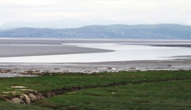
Photo: Eiffel, Public domain via Wikimedia Commons
This expanse of water, or more often mud, stretches away across to Cartmel and the Furness peninsula, with impressive sunsets and views over the Lake District mountains. It's a haven for bird life, both resident and migratory. Historically the route north to Carlisle was to cross the sands at low tide then continue round the coast, with the "Queen's Guide" (first appointed in 1548) leading the way. He still does in summer, though nowadays the guided walks start from Arnside further north. Never venture out across the sands unless you are familiar with the area, the tide times, and the hidden gullies that will flood behind you and cut you off.
Morecambe Bay forms part of the Irish Sea, bordered by the English counties of Cumbria to the north and Lancashire to the east and south. It is the largest expanse of intertidal mudflats and sand in the United Kingdom, covering a total area of 120 sq mi (310 km2). In 1974, the second largest gas field in the UK was discovered 25 mi (40 km) west of Blackpool, with original reserves of over 7 trillion cubic feet (tcf). At its peak, 15% of Britain's natural gas supply came from the bay but production is now in decline. Morecambe Bay is also an important wildlife site, with abundant birdlife and varied marine habitats.
© OpenStreetMap contributors