//

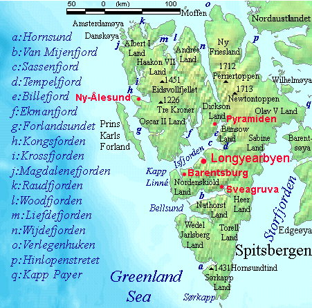
Photo: No machine-readable author provided. TheGrappler assumed (based on copyright claims)., Public domain via Wikimedia Commons
The southernmost point of Spitsbergen and where the Greenland Sea, Baltic Sea and the Norwegian Seas all meet.
Sørkapp is the southernmost point on Sørkappøya, 8 kilometres (5.0 mi) south of Spitsbergen, the largest island in the Svalbard archipelago, Arctic Norway. It was originally named Point Lookout (1612). The cape itself is 1 kilometre (0.62 mi) long. The point is bordered by the Greenland Sea to the west, the Norwegian Sea to the south and the Barents Sea to the east. The point is within the Sørkapp Bird Sanctuary.
© OpenStreetMap contributors
South Cape Island
A small 7 km by 7 km island that used to be a site that Russia used in the 18th century to hunt walruses and whales, and while there are not many remnants of Russia's hunting presence, there are some old graves that can be found here. Today, the island is a haven for geese and ducks.
A large inland piece of land that is home to two glaciers – Hambergbreen and Hornbreen.
A bay in the park's southwest which was once the site of several major whaling stations, likely during the 17th century. While most of Svalbard's former whaling stations are now no more than a piece of wood lying around, there is a cabin in Gåshamna that, while largely destroyed, is made from whale bones.
A Polish research facility erected in 1957; the base now has several research projects.