Money and payments
Cards and cash
Credit and debit cards are accepted at many places that cater to tourists as well as at some upscale shops.
Tipping
Bars, restaurants and hotels include a 10% service charge in the bill, so tipping is not required.


 Americas · South AmericaOutline guide
Country in South America
Photo: NASA, Public domain via Wikimedia Commons
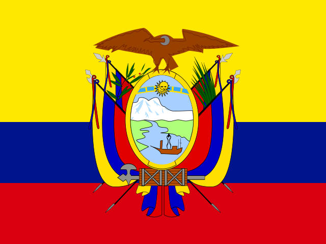
Ecuador is a country on the Equator in northwestern South America. Several places in the country have been declared UNESCO World Heritage Sites, including the Galapagos Islands and the cities of Quito and Cuenca, which lie in the Andes that run from north to south through the country. The Ecuadorian Andes are also home to some of the highest active volcanoes such as the Cotopaxi.
Answers to what travellers most often look up about Ecuador.
Cards and cash
Credit and debit cards are accepted at many places that cater to tourists as well as at some upscale shops.
Tipping
Bars, restaurants and hotels include a 10% service charge in the bill, so tipping is not required.
Spanish
Spanish is the official language. Amerindian languages (especially Quechua) are generally spoken in the more rural, mountainous villages.
Visitors making an extended stay or traveling far should consider purchasing a prepaid SIM card (a chip).
Mobile networks
Bottled water is key in Ecuador if you don't want to get sick.
Ecuador is widely considered to be a developing country and health hazards are a significant issue.
The common greetings are "buenos días", "buenas tardes" or "buenas noches", (Good morning, Good afternoon, and Good evening, respectively).
Attractions, food, stays and travel essentials, with ratings, reviews, opening hours and directions.

the second highest capital in the world (after La Paz) and second largest city in Ecuador with a well preserved colonial center. Its weather is generally spring-like all year long and relatively unpredictable, changing rapidly.

the central city of Ecuador. Special celebrations during Carnival time.

city at the foot of the Tungurahua volcano which used to be active until a few years ago. There are also many hot spring mineral baths.

The third largest city in Ecuador and listed as a UNESCO World Heritage Trust site.
the country's largest city, with its largest port.

town of 100,000 inhabitants halfway between Quito and the northern border.

the oldest colonial city.

small town one-and-a-half hours north of the capital; famous for its Saturday market of indigenous crafts and livestock.

Gateway to the northern Oriente and up-and-coming mountain town -- still has sleepy small-town feel.

Small beach town.

A lesser visited city to the north of some of the most popular beaches in Ecuador.

A cosy and authentic Andean village though easy accessible.

A small Andean city famous for its Carnaval celebrations.

Excellent bird watching in a cloud forest setting.

World-famous surfing beach and beach hangout.

Beautiful small ocean side city, access point for Machalilla National Park, and Isla de la Plata "Poor Man's Galapagos".

Amazon rain forest town frequently destination of downhill bicycle rides from Baños.

An Andean travel route that encompasses Quilotoa volcanic crater lake, Zumbahua and Chugchilán. Quintessential Andean landscapes and cultural experiences.

Beautiful beach and boardwalk, swamped with Guayaquileños during holidays.

Amazon rain forest town famous for some of the best white water rafting and kayaking in Latin America.

Popular for expats living and retiring, and famous for its legendary older inhabitants whom claim to have some of the longest lifespans in the world.

Ecuador has 11 national parks and other types of reserves protecting an area of 26 million hectares (almost 20% of the country's total territory). The parks include some of Ecuador's most spectacular natural wonders.
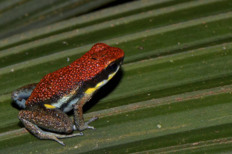
Cuyabeno Wildlife Reserve (Reserva de Producción Faunística Cuyabeno) is well-known to be one of the areas with the most biodiversity on earth. The reserve is located in the Sucumbíos province, in the Ecuadorian part of the Amazon rainforest.

Parque Nacional Cotopaxi is a national park in the central Andes of Ecuador about 50 km southeast of central Quito. It is a popular hiking destination which is known for the active Cotopaxi and the dormant Rumiñahui volcanoes.

Pululahua Geobotanical Reserve is 17 km north of Quito in the province of Pichincha of Ecuador.

a
Places in Ecuador on the World Heritage List.

Historic Center of Quito
Listed 1978

Historic Centre of Santa Ana de los Ríos de Cuenca
Listed 1999

Galápagos Islands
Listed 1978
List from Wikidata (CC0). Photos from Wikimedia Commons.
The Amazon is a region of Ecuador.
The Andean Highlands are a very scenic region in Ecuador. At an elevation of over 2,200 m (and often a lot more!), they offer a breathtaking natural experience.
The Coastal Lowlands is a region in Ecuador. Here you can find nice beaches, a tropical climate, and a laid back atmosphere.
Isolated archipelago that is world-renowned for its unique wildlife and Darwin's evolution research.
Public transport and paid services in Ecuador.
By train
All train services were suspended in 2022.
By car
It is possible to rent a car in the major cities such as Quito, Guayaquil and Cuenca, where car rentals are generally located outside the airports.
By motorcycle or scooter
It is possible to rent daily or weekly motorcycles or scooters. Rates range from $29-$225/day for 150cc-1050cc machines respectively.
By taxi
Taxis are widely available. Taxis are generally yellow and have the taxi license number prominently displayed. Taxis in Quito have meters (fares under $1 are rounded up to the minimum fare of $1).
By plane
Domestic flights between major cities on the mainland cost $50-100 one-way, and there are sometimes roundtrip promotions for about the same price.
Apps for booking a taxi or a ride in Ecuador.
Finding apps for Ecuador…
Other ways to travel:By hitchhiking
Operators checked against their official websites in October 2026; services that have stopped running are not listed. Logos and Wikipedia links: Wikidata (CC0)
Choose an airport to see hotels, stations, taxi ranks and car rental desks around it.
Quito · International · UIO
Loading places around the airport…
Calculated from climate averages: mild daytime highs and lower rainfall. It does not account for festivals, crowds or prices.
Average conditions in Quito
| Jan | Feb | Mar | Apr | May | Jun | Jul | Aug | Sep | Oct | Nov | Dec | |
|---|---|---|---|---|---|---|---|---|---|---|---|---|
| Avg. high | 22° | 21° | 21° | 22° | 23° | 23° | 24° | 24° | 24° | 23° | 22° | 22° |
| Avg. low | 13° | 13° | 14° | 14° | 13° | 12° | 11° | 11° | 12° | 12° | 13° | 13° |
| Rainfall (mm) | 139 | 143 | 176 | 177 | 122 | 58 | 34 | 25 | 38 | 76 | 90 | 100 |
| Humidity | 86% | 86% | 86% | 86% | 84% | 80% | 77% | 74% | 75% | 80% | 81% | 84% |
Choose your passport and destination to see whether you need a visa.
Budget
$45
Per person, per day
Mid-range
$130
Per person, per day
Luxury
$340
Per person, per day
| Budget | Mid-range | Luxury | |
|---|---|---|---|
| Accommodation | $25 | $75 | $200 |
| Food and drink | $10 | $25 | $60 |
| Local transport | $5 | $10 | $30 |
| Activities | $5 | $20 | $50 |
Estimate from World Bank price levels (2025). Actual costs vary by city and season. World Bank
—
We do not label countries as safe or unsafe. Below is the official advice from two governments, with the date it was last updated. Always read the full advice before you travel.
US Department of State
Level 2 of 4Exercise increased caution
Exercise increased cautionin Ecuador due to risk of crime, terrorism, unrest, and kidnapping. Some areas have increased risk. Read the entire Travel Advisory. U.S. government employees working in Ecuador are not allowed to travel to these areas due to safety risks: In Guayaquil, Nueva Prosperina and Pascuales districts, and all areas south of Portete de Tarqui Avenue. Huaquillas and Arenillas, in El Oro province. Quevedo, Quinsaloma, and Pueblo Viejo, in Los Rios province. Duran, in Guayas province. Esmeraldas City and all areas north of Esmeraldas City, in Esmeraldas province. The area north of Esmeraldas City to the Colombian border and east to Carchi province. The U.S. government has limited ability to offer emergency services to U.S. citizens in these areas due to the safety risks. Crime and kidnapping. Crime is a widespread problem in Ecuador. Violent crime connected to drug trafficking is common, including murder, assault, kidnapping, and armed robbery. Areas with transnational criminal organizations have much higher rates of violent crime. U.S. citizens and U.S. lawful permanent residents have been victims of kidnapping and extortion. Terrorism There is risk of terrorist violence, including terrorist attacks and other activity in Ecuador. Visit the U.S. Department of State's country reports on terrorism to learn more. Unrest Demonstrations happen across the country. They are usually driven by political or economic reasons. Demonstrators often block local roads and major highways without warning. Demonstrations can also disrupt transportation and other essential…
UK Foreign, Commonwealth & Development Office
Advises against all but essential travel to parts of the country
Your travel insurance could be invalidated if you travel against advice from the Foreign, Commonwealth & Development Office (FCDO). Areas where FCDO advises against all but essential travel Coastal Region FCDO advises against all but essential travel to the Coastal Region provinces of: Esmeraldas Manabí Santa Elena Guayas El Oro Los Ríos Santo Domingo de los Tsáchilas This does not apply to airside transit within Guayaquil Airport in Guayas province. Within 20km of the Ecuador-Colombia border FCDO advises against all but essential travel to areas within 20km of the Ecuador-Colombia border, except for these areas in Carchi province: El Ángel Ecological Reserve Rumichaca border crossing the town of Tulcán the Pan-American Highway Find out more about why FCDO advises against travel. State of Emergency The Ecuadorean government has declared a 60-day state of emergency as of 15 September, for security reasons in the following 8 provinces: Guayas Manabí Santa Elena Los Ríos El Oro Pichincha Esmeraldas Santo Domingo de los Tsáchilas The state of emergency includes the following cantons: La Maná (Cotopaxi province) Las Naves (Bolívar province) Camilo Ponce Enriquez (Azuay province) The State of Emergency will mean greater police and military presence on the streets. It includes curfew hours (from 12am to 5am) for the provinces of El Oro, Guayas, Los Rios and Manabi, from 17 to 30 September. Follow the advice of local authorities and monitor local media. Before you travel No travel can be guaranteed safe. Read all the advice in this…
Stories, itineraries and practical advice for travelling in Ecuador.
 Travel tips
Ecuador has historical and renovated haciendas or traditional ranches. Haciendas often cover large areas of land and incorporate agricultural operations and other businesses.
Wikivoyage
Nature & adventureEcuador has 11 national parks and other types of reserves protecting an area of 26 million hectares (almost 20% of the country's total territory). The parks include some of Ecuador's most spectacular natural wonders.
Wikivoyage
 Nature & adventure
The wildlife is the prime reason for visiting the Galapagos Islands in Ecuador. The logistics of travelling to and around the islands as well as information on the islands is given in the Galapagos Islands article…
Wikivoyage
 Itineraries
The Quilotoa Loop is a challenging 3-to-5-day hike in Ecuador that takes you through high Andean villages and past Laguna Quilotoa, a crater lake surrounded by volcanic peaks.
Wikivoyage
 Itineraries
If you find yourself in Buenos Aires and want to do some overland travel in South America, why not make your way north, through northern Argentina and Bolivia all the way to the ancient city of Machu Picchu.
Wikivoyage
 Culture & history
Before Europeans arrived in South America, the continent was home to a variety of flourishing civilizations and cultures. Some of these cultures remain today; others have left incredible ruins.
Wikivoyage
Every section of the guide. Open one to read it in full.


