//


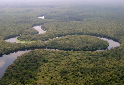
Sedimentary basin of the Congo River in Central Africa
Photo: Imagico, CC BY-SA 2.5 via Wikimedia Commons
Congo Basin is a region in Democratic Republic of the Congo and is made up by the provinces of Equateur, Oriental and Maniema.
From the travel guide. Select a place for details, a map and what is nearby.
On the edge of Kisangani, these are the last cataracts on the Congo until Kinshasa/Brazzaville. Fishermen set up conical traps for fish and can be seen tending to these traps. Some have realized that tourists want to see them and there are reports that they will charge $$ to see them (stopping you before reaching the river) and/or photographing them.
See the "get in" section for details. A trip by boat along the Congo is one of the world's greatest wild adventures. Trips by pirogue for a few hours or a few days can be arranged in most cities along the river. Only a couple tour operators in the country offer these rides, but if you speak good enough French or Swahili, you can probably talk a pirogue owner into a short trip (make sure you understand what you're doing & where you're going).
By plane
As of 2012, the only scheduled services in the region are: FlyCAA which serves Kisangani (FKI), Mbandaka, Bumba (BMB), & Kindu and Congo Airways (Kisangani, Goma, Kindu & Kinshasa).
By car/bus
The only decent option to reach the Congo Basin by road is National Route 4 from Bukavu on the Rwandan border in South Kivu to Kisngani.
By train
The only train line entering the Congo Basin connects Kindu with Lubumbashi in the Katanga region.
By air
There are no scheduled, commercial flights within the region except for, possibly, Mbandanka-Kisangani or Kisangani-Kindu.
By road
Almost all of the roads away from the cities are nothing more than muddy tracks.
By train
There are three lines in the Congo Basin. The line connecting Kindu with the Katanga region will make stops at some of the towns along the line.meaning it may be a couple week between runs.

Bumba is a town of 108,000 people (2009) in Congo Basin region of the Democratic Republic of the Congo on the right bank of the Congo River and close to the confluence of the Itimbiri.
hometown of former dictator Mobutu Sese Seko, and nicknamed Versailles of the Jungle, due to its now ruined lavish palaces.

Third largest city in DRC.

Mbandaka is in Congo Basin. It is the capital of Equateur province.

Zongo is a city in the Congo Basin region of the Democratic Republic of the Congo. Zongo is located on the Bangui River opposite Bangui, the capital of the Central African Republic.
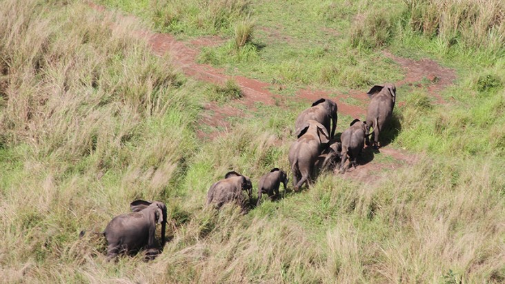
Garamba National Park is a national park in the Democratic Republic of the Congo. It was declared a UNESCO World Heritage site in 1980.

Maiko National Park is in the Congo Basin region of the Democratic Republic of the Congo (DRC).

Okapi Wildlife Reserve is in the Democratic Republic of the Congo.
Articles and travel topics about Congo Basin and DR Congo.
 Nature & adventure
African flora and fauna is a highlight of trips to Africa, especially on visits to the continent's national parks. Going on a safari is a common way to see it.
Wikivoyage
 Nature & adventure
As of 2023 the UNESCO World Network of Biosphere Reserves is made up of 738 reserves in 134 countries of which 22 are transboundary.
Wikivoyage
 Itineraries
The Nile (Arabic: النيل, an-Nīl), is Africa's longest river, and by most definitions the longest in the world at 6,695 kilometers (4,132 miles) from its source White Nile in Burundi/Rwanda to its mouth at the Egyptian…
Wikivoyage
 Nature & adventure
Many of these parks are on the UNESCO World Heritage List. They can be visited for safaris, to see the African flora and fauna.
Wikivoyage
Every section of the guide. Open one to read it in full.