//

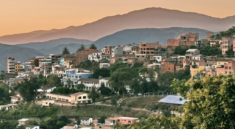
National Road in Bolivia, known for its treacherous journey
Photo: Fernando Jauregui, Canon20d, [www.hotelesemeralda.com],, Public domain via Wikimedia Commons
The Yungas Road is in the La Paz department of Bolivia. If you've ever heard of "Death Road" or "The most dangerous road in the world", this is where it is!
From the travel guide. Select a place for details, a map and what is nearby.
Three picturesque waterfalls about 10 km away from Coroico, one way. This is a full day hike. Especially the third waterfall, La Jalancha, looks impressive.
A black Afroboliviana community with its specific music and dresses. Read on their history and pay them a visit.
Here you will find a surprise: a European castle, built in the 1930s, emerges in the middle of the coca and flower growing region. It's a treat because the people who run the castle/hotel have built many narrow roads for hiking through mountains and mountain cascades. Much calmer and relaxing than Coroico. The hotel is called the Hotel y Parque Ecológico el Castillo del Loro.
30 minutes away from Coroico there is this community project that offers canyoning and trekking. Canyoning involves rappelling down 8 natural waterfalls with pure, fresh, crystal clear water in the middle of the Yungas Jungle. You can also enjoy trekking through the Yungas tropics appreciating nature and fauna, breathing healthy full of oxygen air. FB.
River swimming.
A nice swimming pool next to a waterfall, in case it gets really hot.
Zzip the Flying Fox
A 1,500-m zipline developed by the community in 2010. It flies at speeds of up to 85 km/h. Besides this station there is another higher one across the river. Maybe you can go from this one the whole way. Check it out in case you go by with the bicycle.
Iron Road / Via Ferrata
The communities San Juan de la Miel and Villa Ascensión offer this commercial 6-hr adventure tour along 5 different "iron activities": abseiling, iron steps, a hanging bridge of 30 m, a 100-m zip line, and a rope swing. The "road" is both, vertical and horizontal, equipped with nails, dams, staples, chains, handrails, suspension bridges and zip lines. They allow safe access to otherwise difficult areas.
It is also possible to hike down the North Yungas Road to Cocoico within a day. It is 30 km, but downhill all the time. Or hike up, if you feel like it (2000 m in altitude!), and take any bus from the top end back to La Paz.
The most famous is the old Inca Road trek, which was the most important connection between the Yungas and La Paz until the 1930s. This is a beautiful and exciting track that runs northwest of the highway (La Paz-Yolosita) and the North Yungas Road through local villages and down to Yolosita.
This is a road carved in the mountains, with the idea of having a train connection. It never did function, but as a train needs relatively flat terrain, it's a much more accessible option for people not used to walking. It can be done in two or three days, but come well prepared: the first two days you will not encounter any villages.
There is little information available on this trail here. So, you best off heading to a "tourist information" in Coroico and get more details. They will probably tell about where the trail starts and ends. Then consult OpenStreetMap to find the actual trail and rest of details.
You can easily organise a cycling trip yourself. Try renting a bicycle with one of the tour companies that also offer tours. Take a bus from Terminal Provincial Minasa Yungas (or a private van from where you prefer) to La Cumbra at 4,650 m and go from there, or go directly to the beginning of the North Yungas Road, from where it is only 30 km, which may be preferred if the weather at La Cumbra is bad—with mist you will not be able to take pictures anyhow. Buses usually have enough space in their luggage compartment or on the roof. You can stay in the region or head back directly to La Paz with the next bus from Yolosita.
The "Death Road" itself is not difficult, it is just that when accidents happened, cars were often too fast or inattentive. This can be better controlled by bicycle. However, have someone more conservative leading your group, just in case. Since it is downhill all the time, the 60 km are possible in 3-5 hr, depending on the amount of stops and the weather. Front suspension is best, but full suspension is not needed—this is a gravel road used by cars before, it is not an off-road trail. Some tour companies offer their clients really bad and old bicycles, proofing the easiness of the road. Nevertheless, get a good bicycle—the most important thing are your breaks.
There is a check point along the highway, which is only open between 07:00—15:00. The first halt from La Cumbra is a sealed road. The North Yungas Road is gravel. Doing the trip on you won is more authentic, you do not have to start too early, it is cheaper, and you will have more time for yourself and pictures. In addition, it gives you the chance to visit a neglected but very versatile region.
The North Yungas Road is a popular destination for mountain biking tours from La Paz. There are many providers in La Paz that offer the tour. Unfortunately, they have kind of a quasi monopole, because most people will only contact one company and go with them. Hence, their prices are way too high.
Generally, bicycles and people are brought from La Paz into the region. You will ride a bike in the new paved road about a half hour, then enter the most dangerous road in the world, North Yungas Road (a.k.a. Death Road). All together 60 km (3-6 hr), and at the end you are having buffet lunch, showers and a swimming pool in Yolosa. You can of course also stay in the region, but general the tour providers are a little reluctant to take too much luggage.
Apparently a great place for camping near an interesting mine for a visit.
Has cabanas and a large family apartment available
A project of the Asociación Comunitaria de Ecoturismo Urpuma beneficing 25 families in this region.
By bicycle
Usually, if you book a tour, this is the way you come in.
On foot
Likewise, getting dropped off at the beginning of North Yungas Road (Bs. 10-15 by bus), you can hike down into the valley.
There region consists of many interesting hiking and cycling trails.cz. Or just download the according GPX or KML files through Waymarked Trails for such trails on OpenStreetMap.
Read in the guideChoose an airport to see hotels, stations, taxi ranks and car rental desks around it.
La Paz / El Alto · International · LPB
Loading places around the airport…
Articles and travel topics about Yungas Road and Bolivia.
 Itineraries
The Gringo trail is a term for places in Latin America visited by gringos, that is, people from North America or Europe. It is the Western Hemisphere's equivalent of tropical Asia's Banana Pancake Trail.
Wikivoyage
 Nature & adventure
Bolivia has spectacular natural scenery and astounding biodiversity, both of which are protected in its national parks, monuments, sanctuaries and biosphere reserves.
Wikivoyage
 Itineraries
The Jesuit Missions of the Chiquitos are a UNESCO World Heritage Site in the Chiquitania region of Bolivia's department of Santa Cruz.
Wikivoyage
 Itineraries
El Choro Trek is a 57-km trekking route in the La Paz department of Bolivia.
Wikivoyage
Every section of the guide. Open one to read it in full.