//

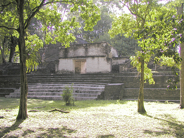
Photo: The original uploader was Aquaimages at English Wikipedia., CC BY-SA 2.5 via Wikimedia Commons
The main attraction in the town. Cahal Pech is a smallish set of Mayan ruins that were abandoned around 800-900 AD. There is an indoor museum displaying artifacts, a site plan, and information on the ruins in a regional context. There are, allegedly, guided tours, but these are unneeded, as the site is easy to traverse. The entire site should take 1-2 hours at most for a thorough exploration. Once at the ruins, the site is fairly flat, but Cahal Pech is at the top of the hill overlooking San Ignacio. The walk uphill to it from the main town is quite exhausting and is difficult even from the San Ignacio Resort Hotel on the hill. If you have any disability, or are in poor physical condition, you will want to drive.
Cahal Pech is a Maya site located near the town of San Ignacio in the Cayo District of Belize. The site was a palatial, hilltop home for an elite Maya family, and though the most major construction dates to the Classic period, evidence of continuous habitation has been dated to as far back as 1200 BCE during the Early Middle Formative period, making Cahal Pech one of the oldest recognizably Maya sites in Western Belize.
© OpenStreetMap contributors
Visit the Iguana Conservation Project and the interpretive Medicinal Jungle Trail at the San Ignacio Hotel. Ranked as one of the best family excursions in San Ignacio.
This is the only suspended road bridge in Belize and connects the twin cities. It was built in 1949 and named after the then-governor. It's a one direction bridge going towards Santa Elena – traffic to San Ignacio goes along the Wooden Bridge further north.
About 20 minutes walk from downtown along Branch Mouth Road. The confluence of the rivers Macal and Mopan, forming the Belize river. In addition to the natural attraction, there's the low-hanging Hammock Bridge (not for people who're afraid of heights), and a small park with a picnic area and a beach.
Follow the Old Benque Road towards the border and then turn left on the Chial Road, drive for 5 km past the airport, and turn left at the fork to get to Chaa Creek. Here you can find two interesting lodging options (see Sleep below), the Rainforest Medicine Trail and the Chaa Creek Natural History Center & Butterfly Farm.
Drive as above, but turn right at the fork. This will take you to a botanical garden with a walking path of about 3 km. Here you can also find an interesting lodge (see Sleep below).
Maya Ruins
Wear good shoes, bring water and plan to spend about 3-4 hours. There is a free hand-cranked ferry in Succotz over the Mopan River. From there you can easily walk the 1 mi (mostly uphill) to the site. As of Oct 2025, the main Visitor Center near the entrance is closed indefinitely. There's a small Education Center (with a few info boards) and a small Visitor Center (displaying stelae) further up the hill, adjacent to the ruins.